Australia, New Zealand, J. N. Bellin, 1753, Carte Reduite des Terres Australes

I don´t sell facsimiles or copies. Bellin, 1753, Carte Reduite des Terres Australes.
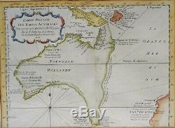
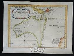
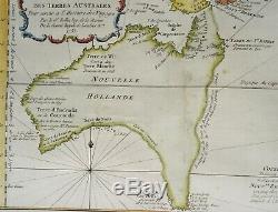
Carte Reduite des Terres Australes. Image 20x27,5cm, page 24,5x33cm. A very nice and first edition example of Bellin's famous early map of Australia, published in'Histoire générale des voyages' in 1754 (the map is dated 1753).
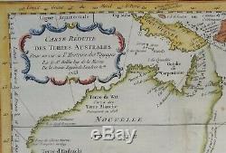
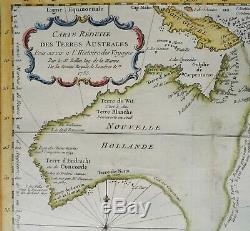
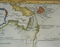
It shows the latest information available about New Holland, as well as puts forth several theories about the still unknown coasts. It is one of the earliest collectable maps of Australia that does not include the Asian continent or the rest of the world. The map provides a fine early depiction of Australia and shows the coastlines of myth and conjecture which began to form in the seventeenth century and were not fully explored until the early nineteenth century.
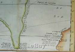
The northern, western, and southern coastlines of the continent are delineated, but the southeastern and eastern coasts are conjectural. Van Diemens Land is still thought to be connected to the main Australian continent, a hypothesis not disproven until Flinders and Basss surveys in the 1790s. Another conjectural coastline connects Carpentaria, in northeast Australia, to New Guinea.This was a holdover from two centuries of maps that exaggerated the size of New Guinea, but also Bellins own combination of other geographic chimeras. In reality, Luís Vaz de Torres, who sailed with Pedro Fernandes de Quiros in 1605, had passed through the straits between New Guinea and Australia.
It also shows part of the coast line of New Zealand, based on the discoveries by Abel Tasman in the 17th century. The remark (in French) next to New Zealand states that it very well might be connected to a large continent that would be the ´antipode of Europe´. I sell original maps, often several centuries old, and they therefore will have signs of age and use. Por favor, estudie atentamente las fotos y el texto para conocer el estado del mapa antes de adquirirlo. Se trata de un mapa original que tiene unos siglos de antigüedad, razón por la que presenta ciertas marcas de uso.En caso de que usted no elija correo certificado, el vendedor no se hará responsable si su paquete no llega bien. Si lo desea, recibirá un comprobante de envío. En caso de que al final no le guste el mapa, puede devolverlo en un plazo de 10 días tras recibirlo. Los gastos de envío (certificado) corren de su cargo.
Cuando el vendedor reciba el mapa, le será devuelto el importe completo de la compra (excluidos los gastos de envío). PUEDEN MANDARSE VARIOS MAPAS EN UN SOLO ENVÍO. The item "Australia, New Zealand, J.
Bellin, 1753, Carte Reduite des Terres Australes" is in sale since Tuesday, January 21, 2020. This item is in the category "Antiques\Maps, Atlases & Globes\Australia/Oceania Maps". The seller is "danievanderstruij0" and is located in Cuacos de Yuste. This item can be shipped worldwide.- Cartographer/Publisher: Jacques Nicholas Bellin
- State/Territory: Australian Capital Territory
- Printing Technique: Copper Plate
- Original/Reproduction: Antique Original
- Format: Atlas Map
- Year: 1753
- Date Range: 1700-1799
- Country/Region: Australia

