Pacific Ocean, Australia, New Zealand, map Bellin, 1753, Carte. De la Mer du Sud
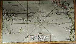
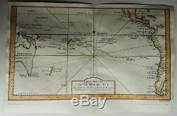
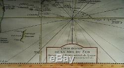
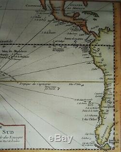

I don´t sell facsimiles or copies. Pacific Ocean, Australia, New Zealand. Carte Réduite de la Mer du Sud. Image 20,5x36cm, page 24,5x38cm. Scarce map of the Pacific with Australia and New Zealand shown according to the discoveries of Tasman and with an imaginary east coast.
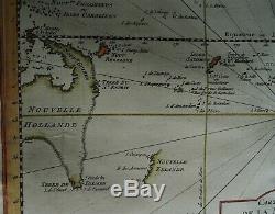
This is one of the few ´pre-Thomas Cook´ maps showing New Zealand. Australia is attached to New Guinea and Tasmania attached to the mainland.
The east coast is entirely imaginary. New Zealand includes only its western coast in an incomplete fashion. This map is remarkable in its historical significance, timed only a few years before the commencement of an intense campaign by the English and French to explore and map Oceana and the South Pacific. Extends from the Marianas and Carolines to the Coast of America, including Baja California, the Gulf of Mexico, Central America and the much of South America, including the Straits of Magellan and Cape Horn.
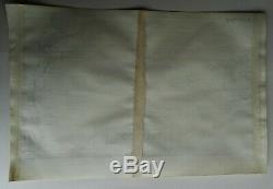
A nice example of this essential collector's map. Dated 1753 and published in volume 11 of ´Histoire Generale des Voyages´, Paris. Left and right margin extended with old paper, left borderline minimally re-drawn. Lower and upper margin wide. I sell original maps, often several centuries old, and they therefore will have signs of age and use. Por favor, estudie atentamente las fotos y el texto para conocer el estado del mapa antes de adquirirlo. Se trata de un mapa original que tiene unos siglos de antigüedad, razón por la que presenta ciertas marcas de uso. En caso de que usted no elija correo certificado, el vendedor no se hará responsable si su paquete no llega bien.Si lo desea, recibirá un comprobante de envío. En caso de que al final no le guste el mapa, puede devolverlo en un plazo de 10 días tras recibirlo. Los gastos de envío (certificado) corren de su cargo. Cuando el vendedor reciba el mapa, le será devuelto el importe completo de la compra (excluidos los gastos de envío). PUEDEN MANDARSE VARIOS MAPAS EN UN SOLO ENVÍO.
The item "Pacific Ocean, Australia, New Zealand, map Bellin, 1753, Carte. De la Mer du Sud" is in sale since Monday, February 10, 2020. This item is in the category "Antiques\Maps, Atlases & Globes\Australia/Oceania Maps". The seller is "danievanderstruij0" and is located in Cuacos de Yuste. This item can be shipped worldwide.
- Cartographer/Publisher: Jacques Nicholas Bellin
- Printing Technique: Copper Plate
- Original/Reproduction: Antique Original
- Format: Atlas Map
- Type: Nautical Map
- Year: 1753
- Date Range: 1700-1799
- Country/Region: American Samoa

