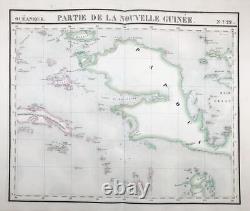
Papua New Guinea Maluku Islands Oceania Asia Map Map Vandermaelen 1827


Oceanique / Partie de la Nouvelle Guinée / No. 22" - Papua New Guinea Maluku Islands Oceania Asia Asie Asien / from: "Atlas Universel De Geographie, Physique, Politique Et Mineralogique.
- Original handcolored lithographic map from Vandermaelen's folio-size world atlas. It is the first atlas produced by the then new printing process of lithography and the first to show the whole world in maps using a large scale resulting in the most detailed maps at the time. - in very good condition. Es ist der erste Atlas, welcher im damals neuartigen Verfahren der Lithographie hergestellt wurde. - This is an original! Many more antique maps and prints on our site antiquariat-voelkel. Viele weitere alte Landkarten, Ansichten und Graphiken auf unser eigenen Seite antiquariat-voelkel. Sicheres Bestellen - Order-Control geprüft!
